TEXTS
Los Angeles River
Los Angeles è un insieme di paesaggi istantanei che attraversi con l'auto. Paesaggi che rimandano a un immaginario fatto di segni, billboards, stores, strade senza fine, colline. Ma la metropoli californiana, dove il sole non tramonta mai, è fatta di paesaggi invisibili, frammentati, che solo una visione lenta, come quella fotografica, ti fa vedere. Il Los Angeles River è un paesaggio nascosto fatto di infrastrutture, ponti, viadotti e dighe alternate alla serialità degli insediamenti industriali e residenziali. Fiume che non viene usato dai cittadini bensì dai filmmaker come set per i film Grease, Terminator 2, Drive, In time, The Core e il famoso videoclip Happy di Pharell Williams. Il paesaggio fluviale non viene vissuto come spazio del tempo libero come accade in Italia ed Europa. Infatti viene percepito come una infrastruttura necessaria ed utile ma non come spazio comunitario, nonostante sia attivo dal 1991 il Los Angeles River Revitalization. Introini ha una visione analitica basata sul ridisegno delle mappe urbane come atto di censimento del territorio ma soprattutto per prendere contatto con i luoghi e sviluppato in una fase successiva con la fotografia. Il fiume o per meglio dire il canale non é visibile dalla strada. Infatti la velocità con cui attraversi la metropoli fissa nella nostra memoria grandi oggetti,naturali e artificiali, ma non quella striscia di acqua e cemento che si estende per 77 km, dall’inizio, alla confluenza del Bell Creek e dell'Arrojo Calabasas, nella San Fernando Valley, fino alla foce nell'Oceano Pacifico a Long Beach. Queste fotografie possono contribuire a far conoscere il paesaggio mutevole del fiume, tra elementi artificiali come i ponti e le dighe contrapposti ad aree in cui si è completamente immersi nella natura e dove non si percepisce più la metropoli.
Emanuele Piccardo, 2019
Los Angeles River, 2016–2017
Il Los Angeles River, anche senza saperlo, lo abbiamo visto in innumerevoli film — da Grease a Terminator e In Time — e in moltissimi video musicali. Ma che cos’è in realtà?
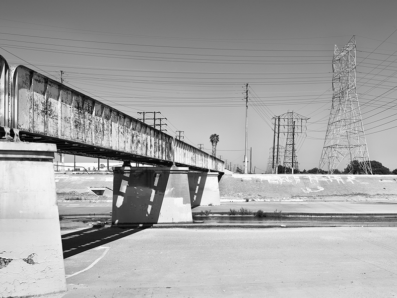
Il L.A. River si presenta come un canale lungo circa 70 chilometri che, nascendo nella San Fernando Valley, corre in direzione ovest-est lungo il versante settentrionale delle Santa Monica Mountains. All’altezza dell’Elyas Park piega verso sud, entrando nella grande pianura di Los Angeles, che attraversa per una quarantina di chilometri fino a sfociare nell’Oceano Pacifico, a Long Beach.
Canale artificiale in cemento, largo per buona parte del suo corso circa 300 metri, il fiume rappresenta un netto taglio nel paesaggio urbano. È il risultato di un lungo processo di regimentazione e di ritracciamento dell’antico corso naturale, iniziato fin dalla fondazione del primo insediamento — El Pueblo de Nuestra Señora la Reina de los Ángeles de Porciúncula — alla fine del XVIII secolo, e culminato con la completa cementificazione negli anni Trenta, in risposta alle devastanti inondazioni che colpivano prima le aree agricole e poi quelle urbanizzate.
La lenta trasformazione, partita da semplici paratie di sabbia e legno, ha portato alla configurazione attuale: un canale lungo il quale si sviluppano oggi le principali infrastrutture ferroviarie e autostradali, rendendo ancora più complesso il suo rapporto con la città. Tuttavia, la crescita urbana e demografica, unita al progressivo calo delle precipitazioni e all’aumento del consumo d’acqua, ha spinto a un ripensamento della funzione urbana e ambientale del fiume.
In alcuni tratti, dove il fondo non è in cemento ma in ciottoli permeabili, si è verificato un fenomeno spontaneo di ricolonizzazione vegetale, accompagnato dal ritorno di specie animali un tempo scomparse. Questo processo, insieme a una maggiore consapevolezza ecologica, ha alimentato il progetto di rinaturalizzazione del fiume, che coinvolge non solo il letto ma anche le sponde, i bacini di laminazione e le aree ferroviarie dismesse, nel tentativo di ricucire il rapporto fra il L.A. River e la città.
L’immaginario cinematografico, invece, ha quasi sempre raccontato il fiume dal basso, dal suo letto: una prospettiva che isola il corso d’acqua dal contesto urbano, accentuandone il carattere estraniante. Raramente, se non in corrispondenza di alcuni ponti storici degli anni Venti e Trenta, è stato mostrato un punto di vista elevato.
Il progetto fotografico intende restituire una lettura diversa, descrivendo il corso del fiume nel suo rapporto con le aree infrastrutturali, industriali e residenziali, alternando vedute dagli argini e dal suo letto, con campi e controcampi che ne esplorano la complessità morfologica e visiva.
Marco Introini, 2019
Los Angeles River
Los Angeles is a sequence of instantaneous landscapes you traverse by car. Landscapes that evoke an imaginary made of signs, billboards, stores, endless roads and hills. Yet the Californian metropolis, where the sun seems to never set, is also made of invisible, fragmented landscapes that only a slow gaze, like the photographic one, allows you to see. The Los Angeles River is a hidden landscape composed of infrastructures, bridges, viaducts and dams, alternating with the seriality of industrial and residential settlements.
It is a river not used by citizens but by filmmakers, as a set for films such as Grease, Terminator 2, Drive, In Time, The Core and the famous music video Happy by Pharrell Williams. Unlike what happens in Italy and Europe, the river landscape is not experienced as a place for leisure time. It is perceived as a necessary and useful infrastructure, but not as a communal space, despite the Los Angeles River Revitalization program being active since 1991.
Introini’s gaze is analytical, grounded in the redrawing of urban maps as an act of surveying the territory, but above all as a way to come into contact with places, a process later developed through photography. The river, or rather the canal, is not visible from the road. The speed at which one crosses the metropolis fixes in our memory large natural and artificial objects, but not that strip of water and concrete stretching for 77 km, from its beginning at the confluence of Bell Creek and Arroyo Calabasas in the San Fernando Valley to its mouth in the Pacific Ocean at Long Beach.
These photographs can help make the river’s mutable landscape known: a landscape suspended between artificial elements such as bridges and dams, and areas where one is completely immersed in nature and the presence of the metropolis is no longer perceived.
Emanuele Piccardo, 2019
Los Angeles River, 2016–2017
Even without realizing it, we have seen the Los Angeles River countless times in films — from Grease to Terminator and In Time — and in many music videos. But what is it, really?
The L.A. River is essentially a canal about 70 kilometers long that rises in the San Fernando Valley and runs west to east along the northern face of the Santa Monica Mountains. Near Elyas Park it turns south, entering the broad Los Angeles plain, which it crosses for about forty kilometers before emptying into the Pacific Ocean at Long Beach.This artificial concrete channel, roughly 300 meters wide along much of its course, creates a sharp incision in the urban landscape. It is the outcome of a long process of controlling and redrawing the original natural course of the river, begun with the foundation of the first settlement — El Pueblo de Nuestra Señora la Reina de los Ángeles de Porciúncula — at the end of the 18th century, and culminating in full-scale concretization in the 1930s, in response to devastating floods that had repeatedly damaged first agricultural land and later urban areas.brainly.
This slow transformation, which started with simple sand and wooden barriers, led to the current configuration: a canal along which the main railway and highway infrastructures now run, further complicating its relationship with the city. However, urban and demographic growth, combined with decreasing rainfall and rising water consumption, has prompted a reconsideration of the river’s urban and environmental role.
In some stretches, where the riverbed is not concreted but made of permeable cobbles, a spontaneous recolonization by vegetation has occurred, accompanied by the return of animal species once thought to have disappeared. This process, together with a growing ecological awareness, has driven plans for the river’s renaturalization, involving not only the channel but also its banks, flood-control basins and disused railway areas, with the aim of repairing the fractured relationship between the L.A. River and the city.
Cinema, by contrast, has almost always portrayed the river from below, from inside its bed: a perspective that isolates the watercourse from the urban context and emphasizes its alien, estranging character. Only rarely — mainly from a few historic bridges built in the 1920s and 1930s — has a higher vantage point been shown.
This photographic project proposes a different reading, describing the river’s course in relation to the surrounding infrastructural, industrial and residential areas, alternating views from the embankments and from within the channel itself, with shot–reverse-shot sequences that explore its morphological and visual complexity.
Marco Introini, 2019
Los Angeles è un insieme di paesaggi istantanei che attraversi con l'auto. Paesaggi che rimandano a un immaginario fatto di segni, billboards, stores, strade senza fine, colline. Ma la metropoli californiana, dove il sole non tramonta mai, è fatta di paesaggi invisibili, frammentati, che solo una visione lenta, come quella fotografica, ti fa vedere. Il Los Angeles River è un paesaggio nascosto fatto di infrastrutture, ponti, viadotti e dighe alternate alla serialità degli insediamenti industriali e residenziali. Fiume che non viene usato dai cittadini bensì dai filmmaker come set per i film Grease, Terminator 2, Drive, In time, The Core e il famoso videoclip Happy di Pharell Williams. Il paesaggio fluviale non viene vissuto come spazio del tempo libero come accade in Italia ed Europa. Infatti viene percepito come una infrastruttura necessaria ed utile ma non come spazio comunitario, nonostante sia attivo dal 1991 il Los Angeles River Revitalization. Introini ha una visione analitica basata sul ridisegno delle mappe urbane come atto di censimento del territorio ma soprattutto per prendere contatto con i luoghi e sviluppato in una fase successiva con la fotografia. Il fiume o per meglio dire il canale non é visibile dalla strada. Infatti la velocità con cui attraversi la metropoli fissa nella nostra memoria grandi oggetti,naturali e artificiali, ma non quella striscia di acqua e cemento che si estende per 77 km, dall’inizio, alla confluenza del Bell Creek e dell'Arrojo Calabasas, nella San Fernando Valley, fino alla foce nell'Oceano Pacifico a Long Beach. Queste fotografie possono contribuire a far conoscere il paesaggio mutevole del fiume, tra elementi artificiali come i ponti e le dighe contrapposti ad aree in cui si è completamente immersi nella natura e dove non si percepisce più la metropoli.
Emanuele Piccardo, 2019
Los Angeles River, 2016–2017
Il Los Angeles River, anche senza saperlo, lo abbiamo visto in innumerevoli film — da Grease a Terminator e In Time — e in moltissimi video musicali. Ma che cos’è in realtà?
Il L.A. River si presenta come un canale lungo circa 70 chilometri che, nascendo nella San Fernando Valley, corre in direzione ovest-est lungo il versante settentrionale delle Santa Monica Mountains. All’altezza dell’Elyas Park piega verso sud, entrando nella grande pianura di Los Angeles, che attraversa per una quarantina di chilometri fino a sfociare nell’Oceano Pacifico, a Long Beach.
Canale artificiale in cemento, largo per buona parte del suo corso circa 300 metri, il fiume rappresenta un netto taglio nel paesaggio urbano. È il risultato di un lungo processo di regimentazione e di ritracciamento dell’antico corso naturale, iniziato fin dalla fondazione del primo insediamento — El Pueblo de Nuestra Señora la Reina de los Ángeles de Porciúncula — alla fine del XVIII secolo, e culminato con la completa cementificazione negli anni Trenta, in risposta alle devastanti inondazioni che colpivano prima le aree agricole e poi quelle urbanizzate.
La lenta trasformazione, partita da semplici paratie di sabbia e legno, ha portato alla configurazione attuale: un canale lungo il quale si sviluppano oggi le principali infrastrutture ferroviarie e autostradali, rendendo ancora più complesso il suo rapporto con la città. Tuttavia, la crescita urbana e demografica, unita al progressivo calo delle precipitazioni e all’aumento del consumo d’acqua, ha spinto a un ripensamento della funzione urbana e ambientale del fiume.
In alcuni tratti, dove il fondo non è in cemento ma in ciottoli permeabili, si è verificato un fenomeno spontaneo di ricolonizzazione vegetale, accompagnato dal ritorno di specie animali un tempo scomparse. Questo processo, insieme a una maggiore consapevolezza ecologica, ha alimentato il progetto di rinaturalizzazione del fiume, che coinvolge non solo il letto ma anche le sponde, i bacini di laminazione e le aree ferroviarie dismesse, nel tentativo di ricucire il rapporto fra il L.A. River e la città.
L’immaginario cinematografico, invece, ha quasi sempre raccontato il fiume dal basso, dal suo letto: una prospettiva che isola il corso d’acqua dal contesto urbano, accentuandone il carattere estraniante. Raramente, se non in corrispondenza di alcuni ponti storici degli anni Venti e Trenta, è stato mostrato un punto di vista elevato.
Il progetto fotografico intende restituire una lettura diversa, descrivendo il corso del fiume nel suo rapporto con le aree infrastrutturali, industriali e residenziali, alternando vedute dagli argini e dal suo letto, con campi e controcampi che ne esplorano la complessità morfologica e visiva.
Marco Introini, 2019
Los Angeles River
Los Angeles is a sequence of instantaneous landscapes you traverse by car. Landscapes that evoke an imaginary made of signs, billboards, stores, endless roads and hills. Yet the Californian metropolis, where the sun seems to never set, is also made of invisible, fragmented landscapes that only a slow gaze, like the photographic one, allows you to see. The Los Angeles River is a hidden landscape composed of infrastructures, bridges, viaducts and dams, alternating with the seriality of industrial and residential settlements.
It is a river not used by citizens but by filmmakers, as a set for films such as Grease, Terminator 2, Drive, In Time, The Core and the famous music video Happy by Pharrell Williams. Unlike what happens in Italy and Europe, the river landscape is not experienced as a place for leisure time. It is perceived as a necessary and useful infrastructure, but not as a communal space, despite the Los Angeles River Revitalization program being active since 1991.
Introini’s gaze is analytical, grounded in the redrawing of urban maps as an act of surveying the territory, but above all as a way to come into contact with places, a process later developed through photography. The river, or rather the canal, is not visible from the road. The speed at which one crosses the metropolis fixes in our memory large natural and artificial objects, but not that strip of water and concrete stretching for 77 km, from its beginning at the confluence of Bell Creek and Arroyo Calabasas in the San Fernando Valley to its mouth in the Pacific Ocean at Long Beach.
These photographs can help make the river’s mutable landscape known: a landscape suspended between artificial elements such as bridges and dams, and areas where one is completely immersed in nature and the presence of the metropolis is no longer perceived.
Emanuele Piccardo, 2019
Los Angeles River, 2016–2017
Even without realizing it, we have seen the Los Angeles River countless times in films — from Grease to Terminator and In Time — and in many music videos. But what is it, really?
The L.A. River is essentially a canal about 70 kilometers long that rises in the San Fernando Valley and runs west to east along the northern face of the Santa Monica Mountains. Near Elyas Park it turns south, entering the broad Los Angeles plain, which it crosses for about forty kilometers before emptying into the Pacific Ocean at Long Beach.This artificial concrete channel, roughly 300 meters wide along much of its course, creates a sharp incision in the urban landscape. It is the outcome of a long process of controlling and redrawing the original natural course of the river, begun with the foundation of the first settlement — El Pueblo de Nuestra Señora la Reina de los Ángeles de Porciúncula — at the end of the 18th century, and culminating in full-scale concretization in the 1930s, in response to devastating floods that had repeatedly damaged first agricultural land and later urban areas.brainly.
This slow transformation, which started with simple sand and wooden barriers, led to the current configuration: a canal along which the main railway and highway infrastructures now run, further complicating its relationship with the city. However, urban and demographic growth, combined with decreasing rainfall and rising water consumption, has prompted a reconsideration of the river’s urban and environmental role.
In some stretches, where the riverbed is not concreted but made of permeable cobbles, a spontaneous recolonization by vegetation has occurred, accompanied by the return of animal species once thought to have disappeared. This process, together with a growing ecological awareness, has driven plans for the river’s renaturalization, involving not only the channel but also its banks, flood-control basins and disused railway areas, with the aim of repairing the fractured relationship between the L.A. River and the city.
Cinema, by contrast, has almost always portrayed the river from below, from inside its bed: a perspective that isolates the watercourse from the urban context and emphasizes its alien, estranging character. Only rarely — mainly from a few historic bridges built in the 1920s and 1930s — has a higher vantage point been shown.
This photographic project proposes a different reading, describing the river’s course in relation to the surrounding infrastructural, industrial and residential areas, alternating views from the embankments and from within the channel itself, with shot–reverse-shot sequences that explore its morphological and visual complexity.
Marco Introini, 2019
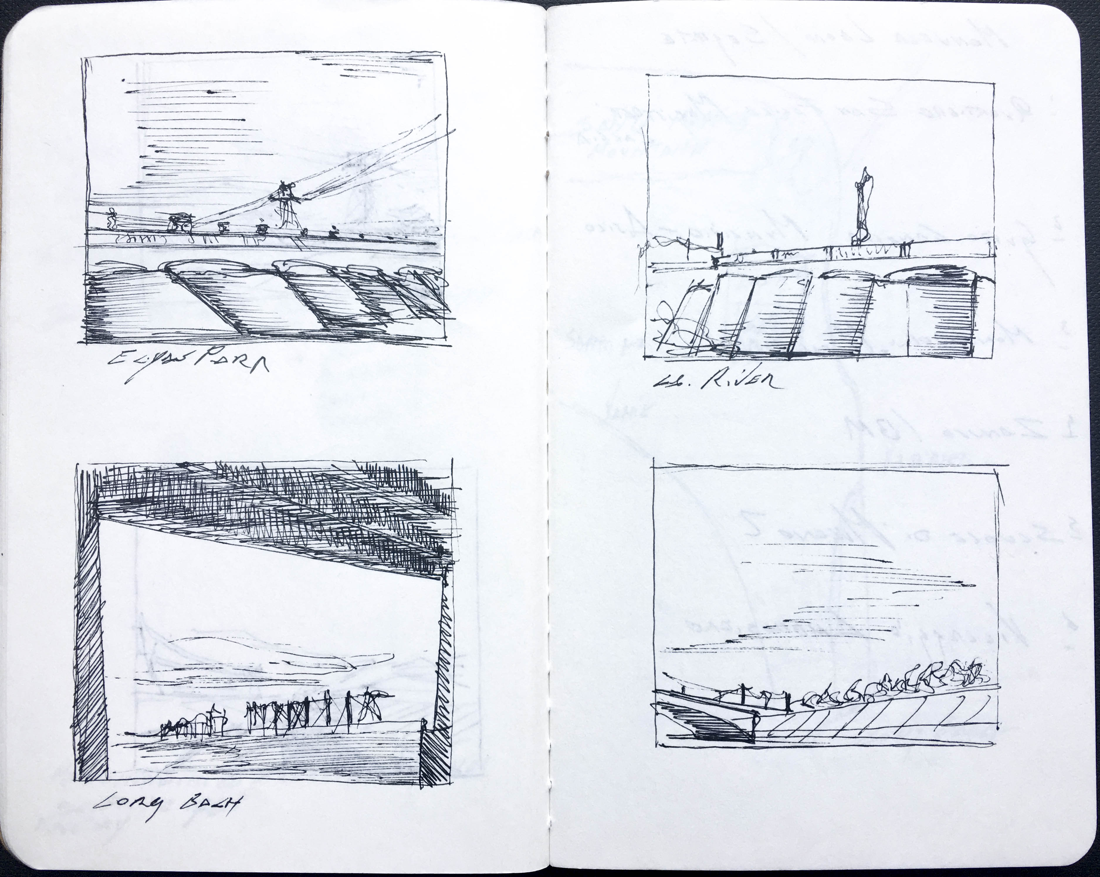
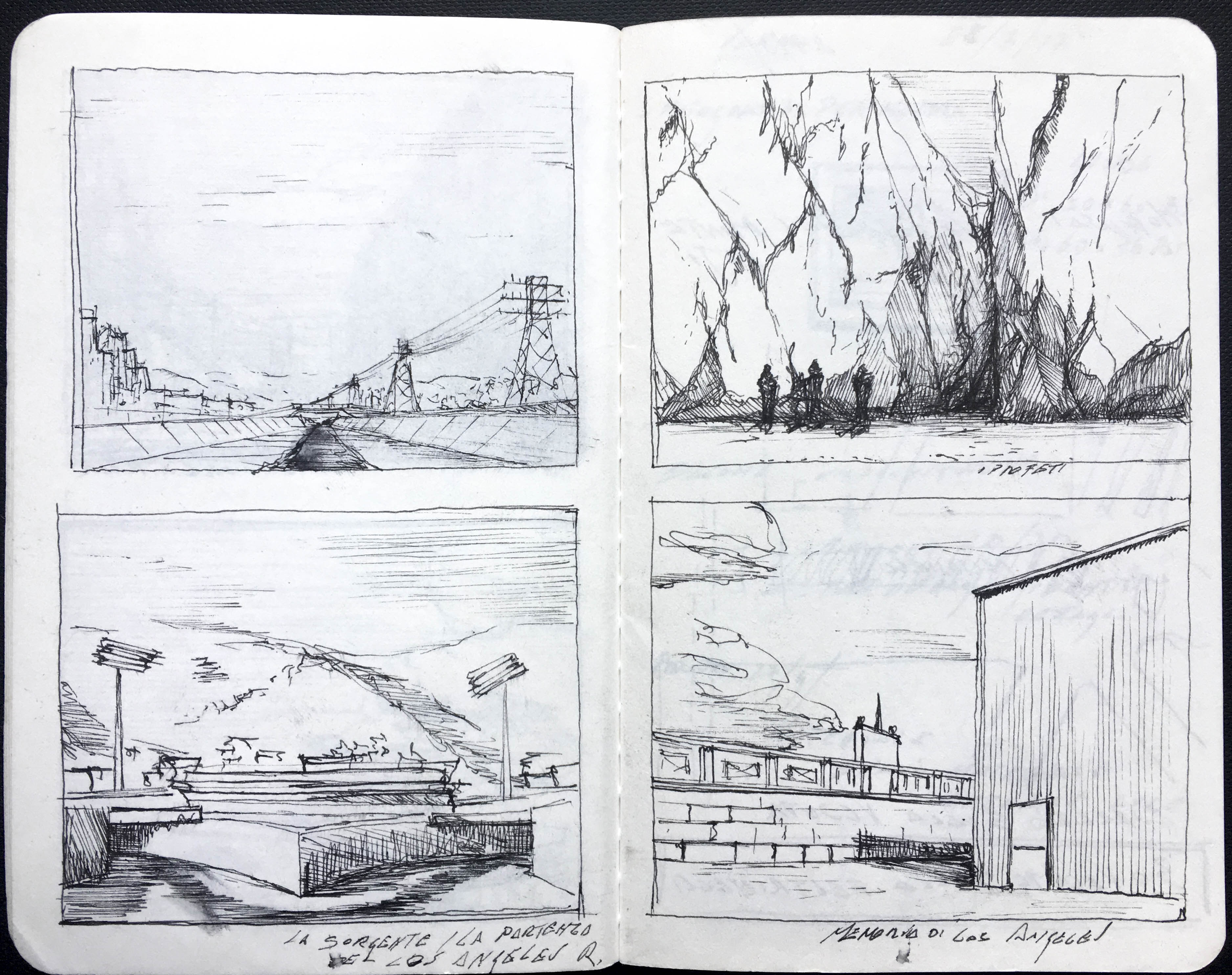
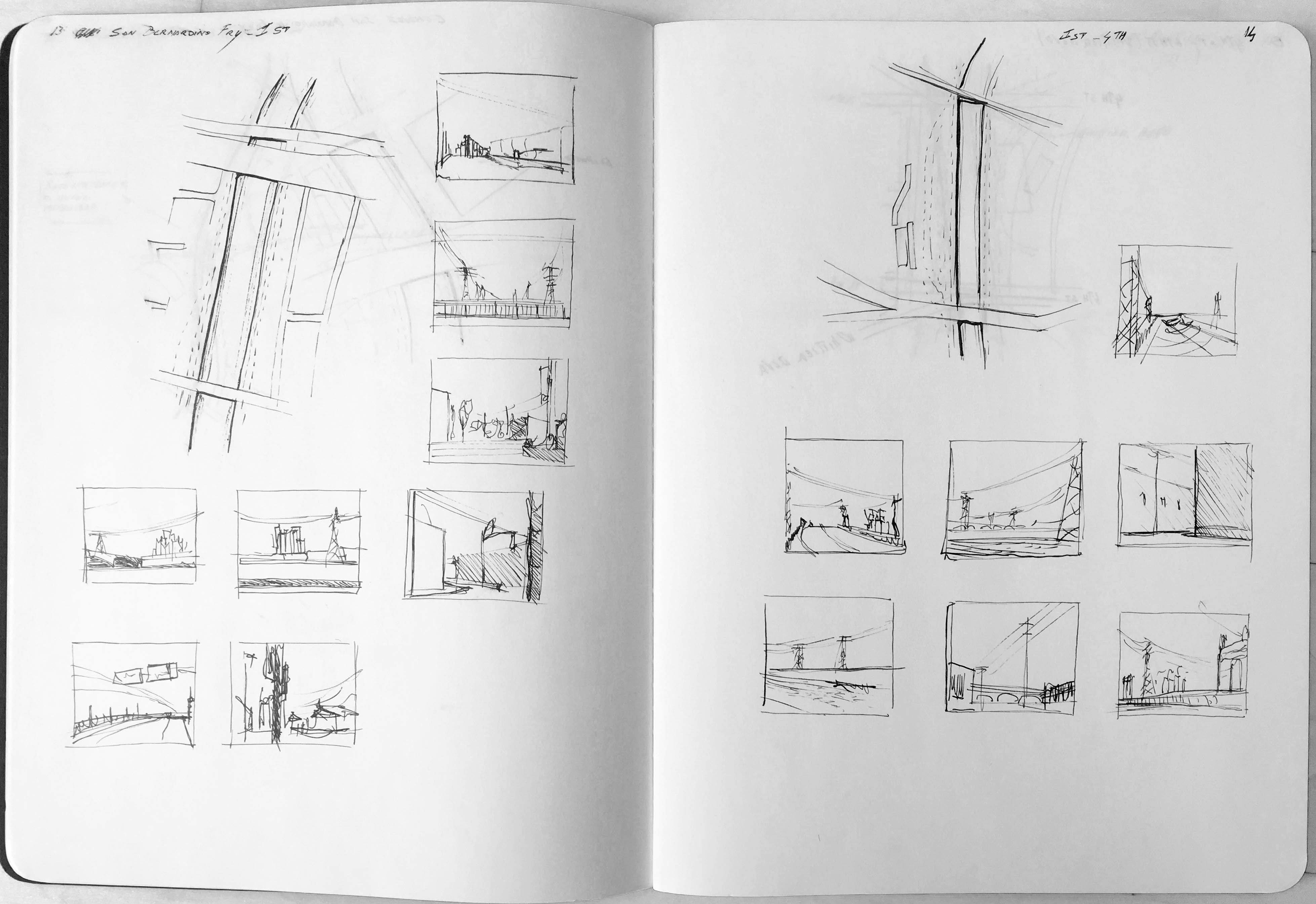
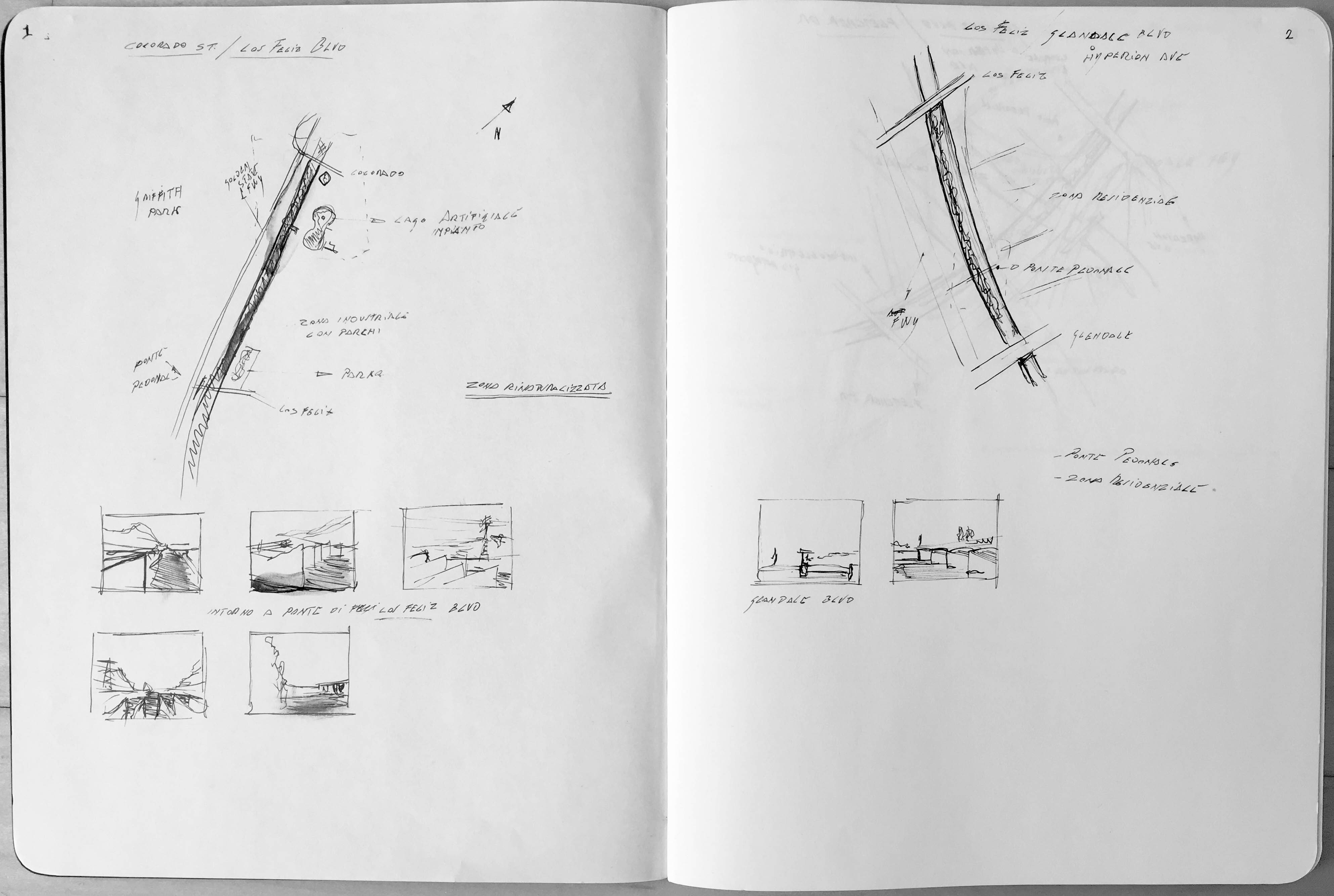
Some sketches before and
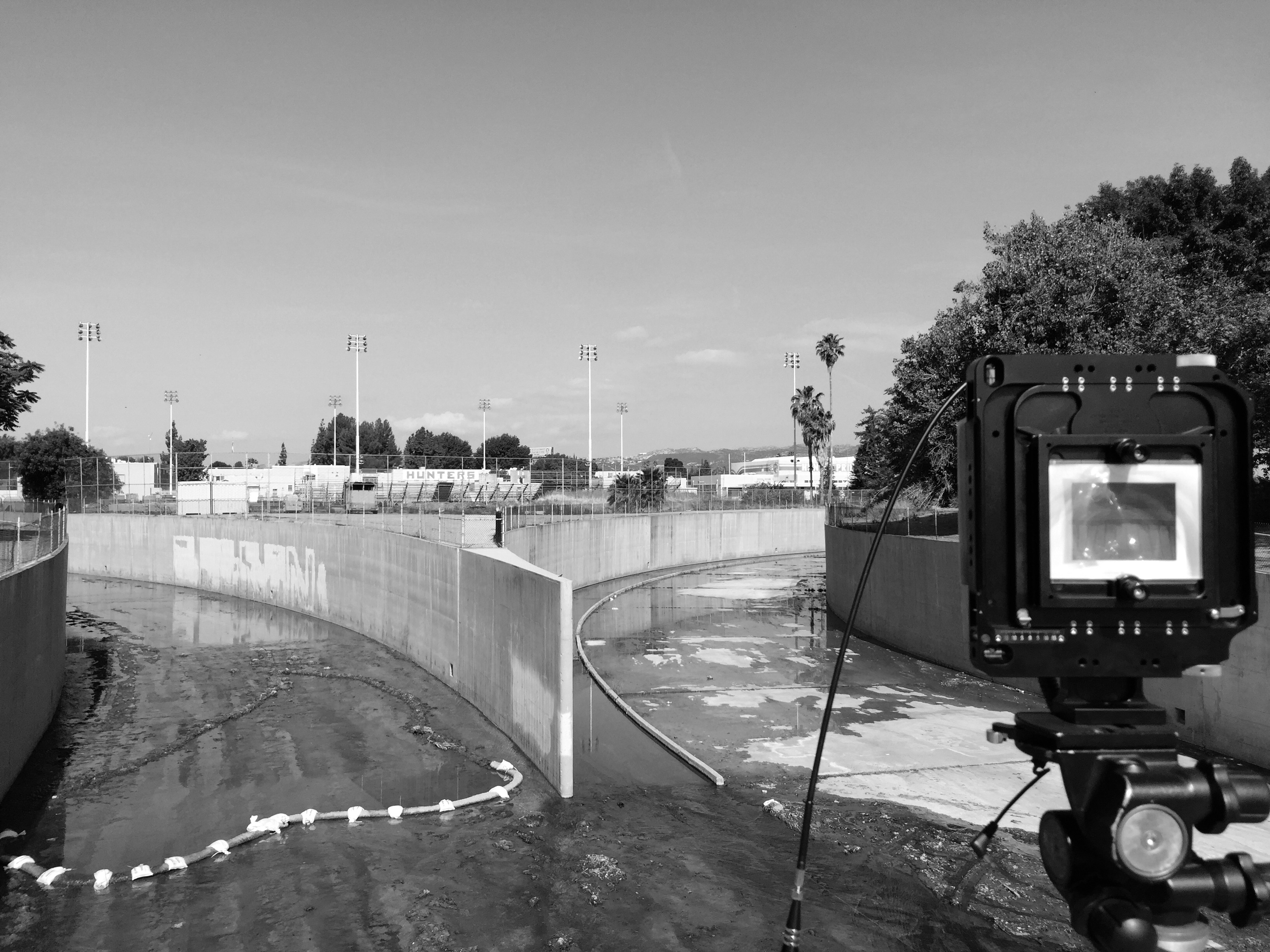
the backstage during the exploration
the backstage during the exploration
to photo work